MIT Sea Grant river chart helps inform land-use planning near Charles River
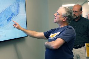 MIT Sea Grant addresses balancing the needs of land development with loss of river use with regard to depth data in areas under consideration.
Recently, there have been two groups proposing development of better walkways and parkland along the Boston/Allston shoreline between the BU Bridge and River Street. Part of the proposals is to build a walkway over the river or to extend the land slightly out into the river. Naturally, river users have an interest in not losing use of the water, stimulating the need for review and evaluation of site conditions.
The discussions between developers and Charles River Alliance of Boaters (CRAB) have been greatly facilitated by MIT Sea Grant through informative knowledge of the river depths in the areas under consideration by the two groups.
Because that section of the river is quite shallow near the shoreline, there is some room to build out into the water without material impact to the river community. This is an ongoing discussion, but one helped by having quantitative data and mapping provided by MIT Sea Grant.


