RIVER HERRING RESOURCES
Mapping, Simulations, and Outreach Materials
We develop new technologies and tools for partners, providing access to data and products that play an integral role in decision-making and public outreach. Our close collaboration with stakeholders acts as a framework for ensuring value-based design.
MIT Sea Grant has a rich history of technical innovation in coastal management, and we are eager to establish new relationships with partners through the development of tools for aquaculture, outreach, coastal adaption, risk assessment, and habitat restoration.
Mapping, Simulations, and Outreach Materials
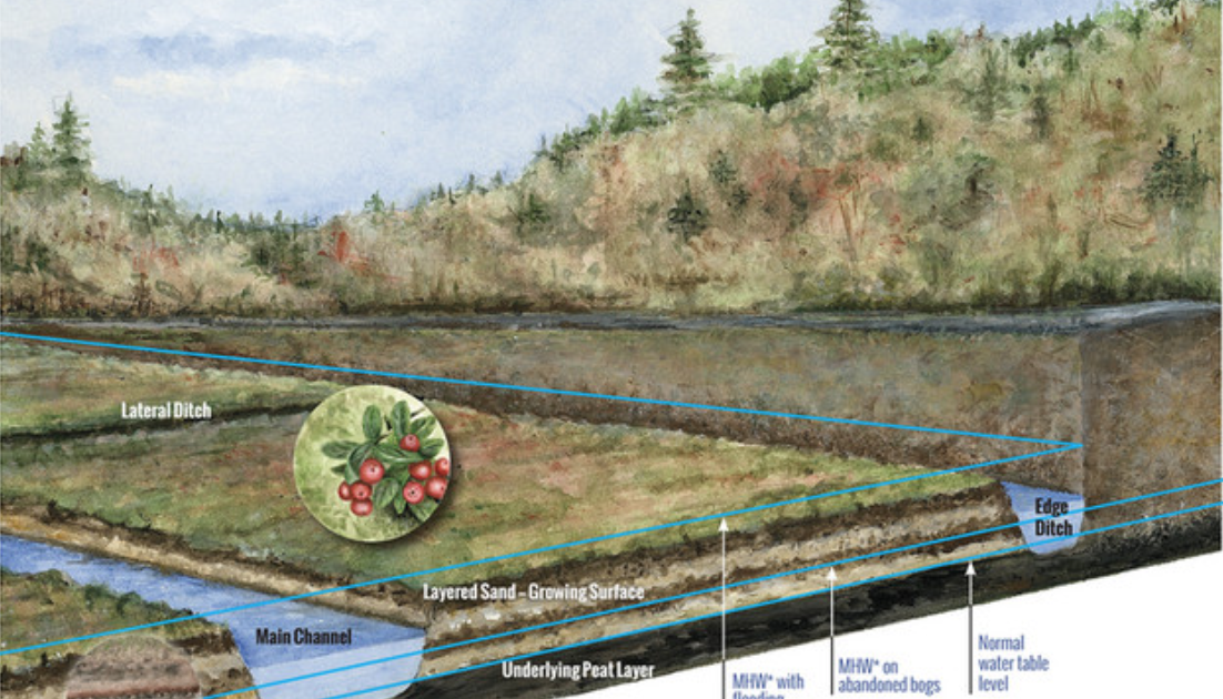
MIT Sea Grant, in partnership with multiple organizations, contributed research, education, and outreach opportunities in support of understanding the effects of coastal wetland restoration on climate impacts, fisheries, and ecosystem processes. The program, guided by the Living Observatory and Massachusetts Division of Ecological Restoration, led to the creation of the Cranberry Bog Restoration Program.
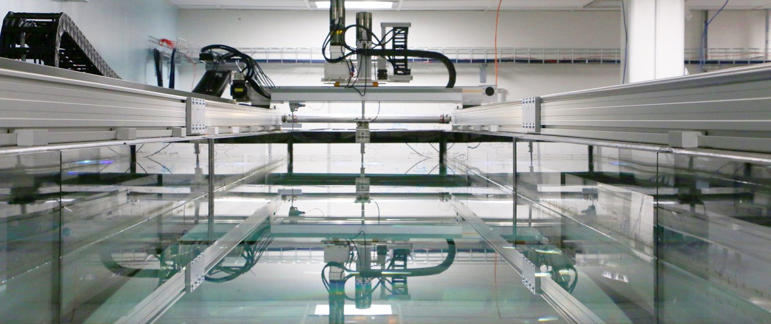
MIT Sea Grant has a number of labs and tanks that may be used, including the Towing Tank and the Teaching Tank. Explore the AUV Lab and other tanks and lab spaces here. Email seagrantinfo@mit.edu for user forms and hourly/daily billing information.
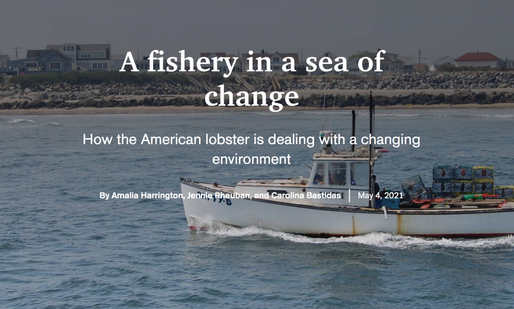
Researchers from Maine Sea Grant, MIT Sea Grant, and Woods Hole Sea Grant shine a spotlight on the American lobster. Researchers participating in the National Sea Grant American Lobster Initiative pulled together the latest science explaining how warming waters in the Gulf of Maine impact lobsters at all life stages. >> View the interactive StoryMap
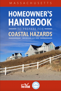
To help homeowners protect their family and their property from natural hazards, Woods Hole Sea Grant and the Cape Cod Cooperative Extension have produced the newly updated Massachusetts Homeowner’s Handbook to Prepare for Coastal Hazards. >> Press Release and Download
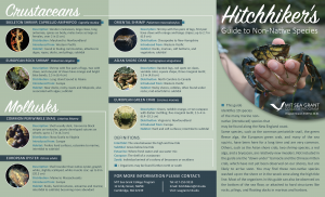
This guide identifies 19 species of the many marine non-native (introduced) species that may be found along the New England coast. Some species, such as the European green crab, have been here for a long time and are very common. Others, such as the Asian shore crab, are relatively new invaders. >> View and Download
Created by Carolina Bastidas and Judith Pederson, MIT Sea Grant, with special thanks to Jim Straub at the MA DCR and Jim Carlton at Williams College.
State, federal, and general resources for the seafood industry during the COVID-19 pandemic

In response to COVID-19 school closures, MIT Sea Grant is compiling and developing at-home educational resources. Explore webinars, fun activities, and distance learning experiences!
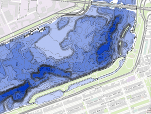
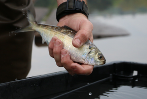
Explore bathymetric maps of the Charles River and river herring spawning ponds for use by state organizations, resource and recreation managers, boaters, and the general public.
Check out this web-based data collection protocol developed by MIT Sea Grant for citizen scientists and the National Park Service, for use in research and management planning.
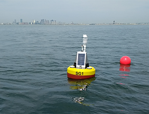
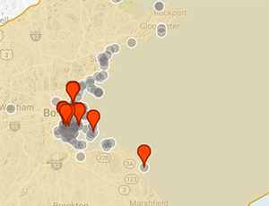
Shore-based ocean acidification monitoring station to support communications, transfer, monitoring, and modeling of data collected by offshore remote sensing technology.
Full website coming soon!
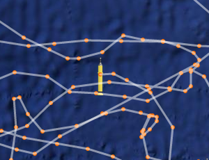
We’re currently testing deployment of drifters with control computer, data storage, sensors measuring pH, temperature and conductivity, GPS navigation, and onboard communication, for use by ocean engineering, modeling, and water quality monitoring programs at the university and state level. Data is available real-time via the web for instant use in desktop and web-based applications.